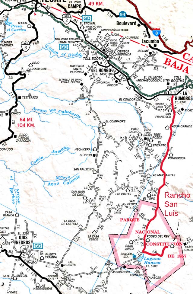
Laguna Hanson (LH) is located in the Parque Nacional de Constitucion de 1857 named for the signing of the Mexican Constitution in 1857. LH is one of the very few places that you can find pine trees in baja. The other is on the 10,000 foot peak of Picacho del Diablo.
LH is a popular place for adventurous campers from the US as well as a usual Sunday afternoon picnic spot for folks from Ensenada and Ojos Negros. There are two basic routes to LH, one from the north, the other from the south. The north route can start either at El Condor or at La Rumerosa. The route from La Rumerosa is a little shorter with the total on-trail distance at 32 miles to the north park entrance. The south entrance comes from Mex Highway 3 and can be accessed from Independencia and several points close to Ojos Negros. The two main southern entrances are marked with signs. Both north and south routes can be traveled with a conventional pickup, assuming careful driving and good weather.
I have traveled both the entrance routes and the north one is more interesting and clearly closer for me since I am coming from the US. The south route is easier in general and has less trail, but does require getting to the entrance which is a beefy highway travel from the US.
Red highlighted path indicates route from La Rumerosa
An interesting side trip from LH is RanchoSanLuis. See this link for more details. Rancho San Luis is a private rancho owned by a couple who homesteaded the land in the 1940's. They came from mainland Mexico near Mazatlan and carved out an meager existence in the rugged mountains of northern Baja. As a side note, Rancho San Luis was on the AAA map for years (which is why I went there in the first place), but has not been on recent editions of the map. This implies that the couple that owned it may have died or moved away. The man did have diabetes, so there is a reasonable chance that he was overcome by events.
The north entrance to LH is from an area called the Tecate Divide. The divide is a brush cover ridge that stretches 30 miles or so. This wind-swept area is devoid of major vegetation due to the wind and fires and like other areas of northern Baja, has decomposed granite as the basis for the sand that comprises all the trails.
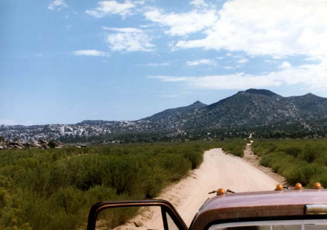
Just south of La Rumerosa, heading south-east into the first set of hills.
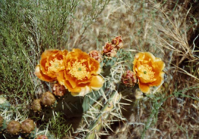
Prickly Pair cactus in bloom along the trail.
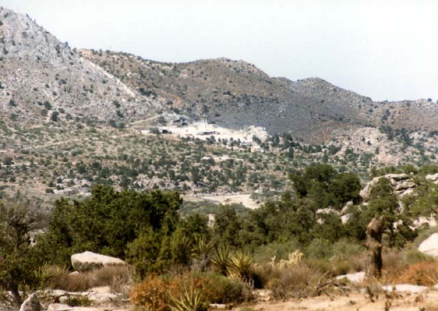
One of several mines and quarries that are near La Rumerosa as viewed from the top of the initial grade. Miners from this area saved us on a previous trip.
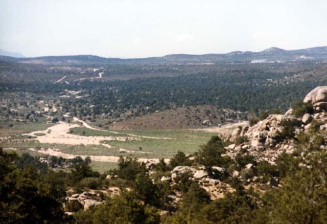
View Looking to the north from the top of the first hill. Note the mines on the right top.
The photo below pretty much embodies back country baja. Animals on the loose without fencing to control their movement. Here, this cow was curious about the noise of the engines, but got confused when the other truck arrived at the same time as we did. These are some serious horns, but note the udder -- this is a cow, not a bull.
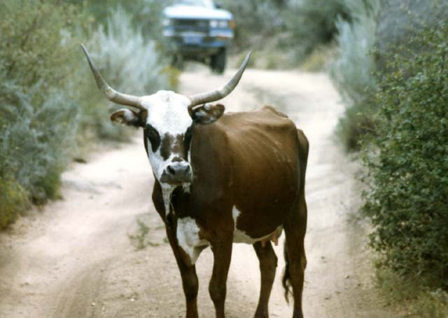
Baja traffic jam.
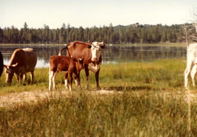
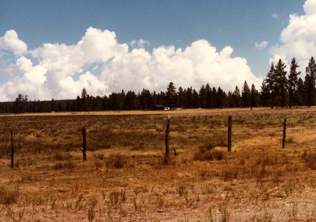
There are a substantial number of ranchos north of the laguna. The area has tall pines and open meadows that support the cattle, horses, mules and pigs that the ranchers need to survive. Note that the grass is short, as the area is heavily grazed.
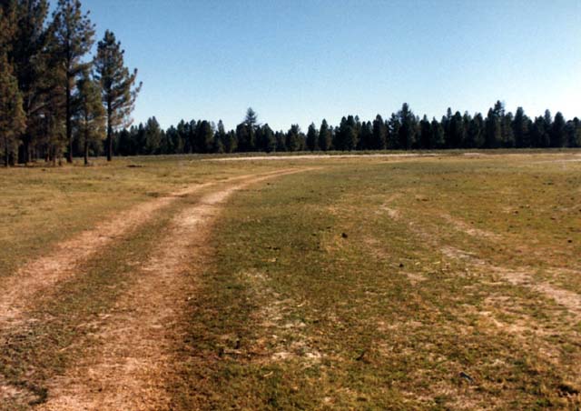
The north meadow at Laguna Hanson.
The area around the lake supports abundant wild life, both human introduced and native. On a number of the trips to the area, we heard mountain lions after dark and in one case, noted that a sow was missing a piglet the next morning after hearing the lion's growl. We assumed that the lion ate the piglet, but could not be sure. Below is a photo of some donkeys and horses grazing to the north of the lake. On one trip, we were up late at night, drinking mescal. As the liquor went to work, the Nancy and Holly went to bed, leaving me alone. As I got drunker, I got entranced by the flickering fire and the coals. Since mescal is a mild hallucinogen, I was starting to see things in the light of the coals -- interesting things. Like small men building cities in the center of the fire. The fire was sufficiently entertaining that I did not hear the devil donkeys approaching me from the rear. When the six of them got close, perhaps within 6 feet before they brayed loudly. The noise scared me so bad that I literally fell out of my chair backwards, crashing to the ground and stirring up a huge cloud of dust. They did not spook and run with my fall, but rather stood there and looked down at me. I could see them, looking up and backwards, and the fire light was reflecting off their eyes giving them a devilish glow. I was freaking out, I thought that I had seen the devil. As I rolled over and stumbled to my feet, covered in dirt and dust, they brayed again and then bolted. The second bray woke up the girls, with them cursing at me to pipe down. When I explained what had happened, they could not stop laughing. The tongue lashing did little to ease my wounded pride.
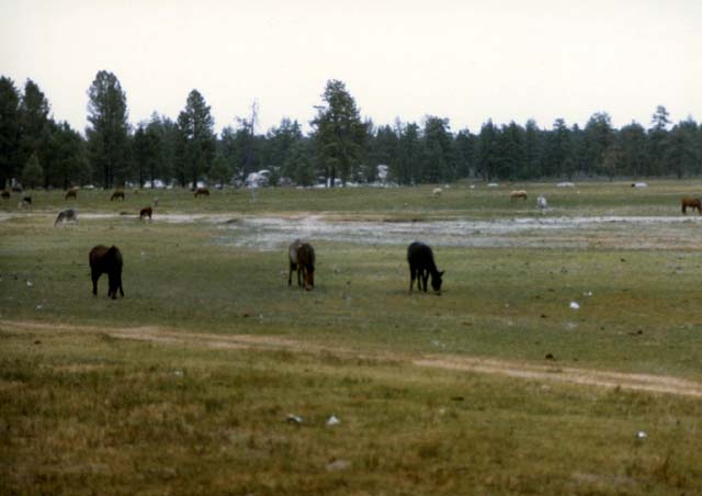
Devil Donkeys: These are semi-wild donkeys and horses in open pasture.
The area around the lake is reasonably lush given that the surrounding area is a desert. Having the lake with large pines and grass is a treat compared to the scrub brush of the Tecate divide. In the spring, large numbers of flowers are present. The size of the lake is determined by the rain in the winter months. During drought years, the lake shore line recedes, resulting in just a large mud hole. In rainy years, the shoreline advances to the point of obstructing the road.
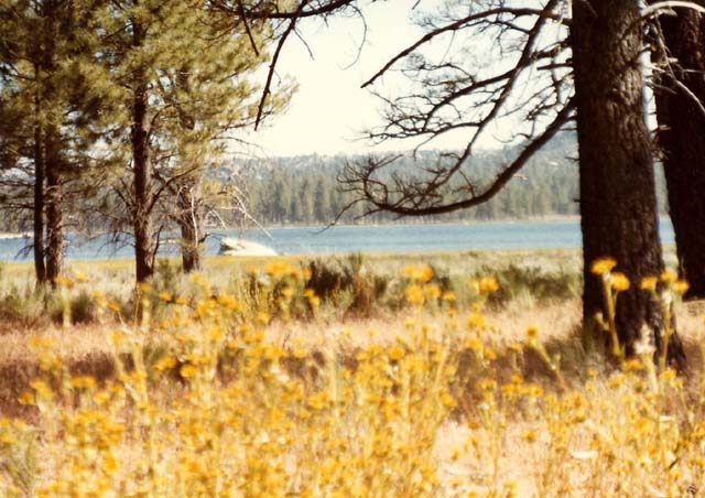
A small view of the lake. Note the flowers and pine trees.
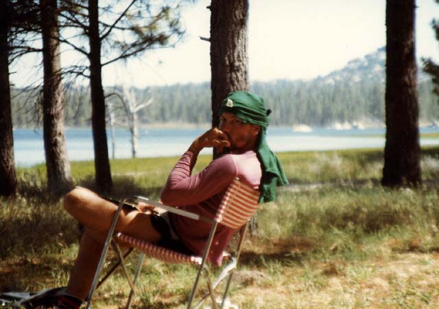
The author taking a break.
Since the land around the lake is open range land, many animals wander through the area. Below, you can see a portion of a herd of cattle that came through the camp. Since cows are big, strong and stupid, and given the experience with the devil donkeys, I was wary. They roam like they own the place, getting into stuff and generating problems. We were concerned that if they spooked, there could be a stampede and we would have to make a run for cover. Gladly, they just raised dust and went to the lake for water.
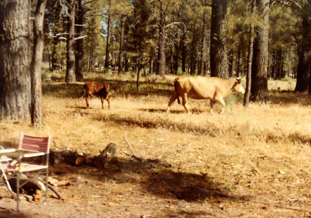
Camp visitors.
Cattle in the camp.
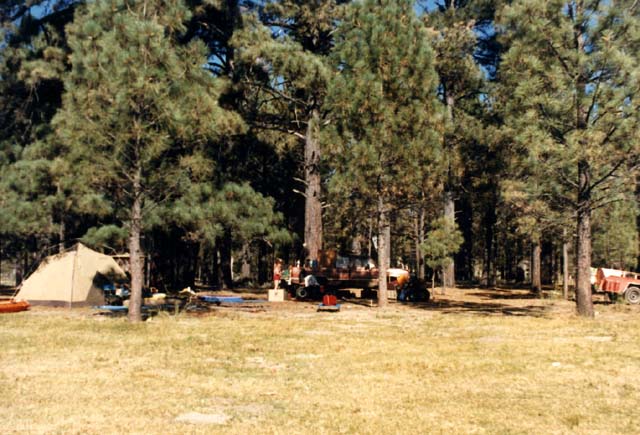
A typical campsite at Laguna Hanson.
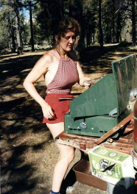
My ex-wife Holly.
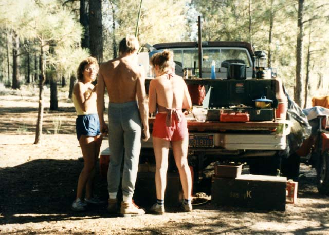
Breakfast banter between Mary Cardon, Bruce Johnson and Holly .
Maxwell, my super-hound.
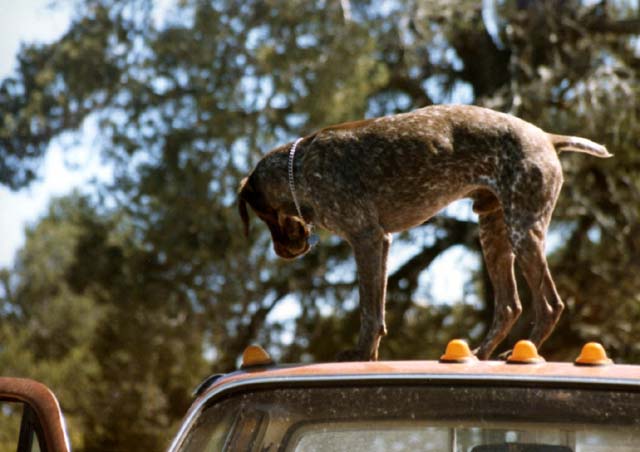
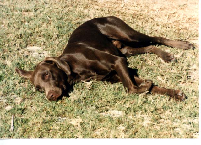
Fritz; the demon seed and dumb as a stump.
The roads to the north of Laguna Hason are the only way that the ranchers can get in and out of the area. As a consequence, these roads are pretty heavily used, even at night. Below, we encounter oncoming traffic.
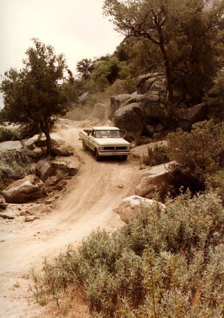
Local traffic at the only tough spot on the trail.
Rest stop on the trail to Laguna Hanson.
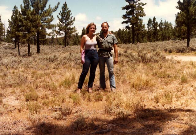
My ex-wife Holly and the Author.
Below is a photo of the fire control camp. The existence of the structure would give the casual visitor the impression that there were resources allocated to fighting fires. As we saw on our side trip to San Luis, that is not exactly correct. They did get the fire under control before it got into the tall pines, but it did consume a very large area to the north of the park.
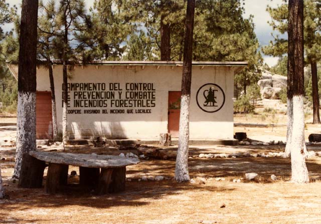
The local fire control camp.
One of the many ranchos to the north of Laguna Hanson.
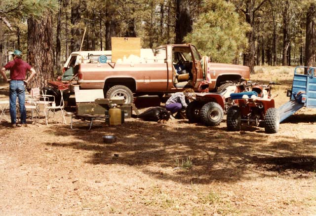
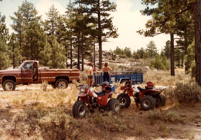
Getting ready for a side trip to Asserradero.
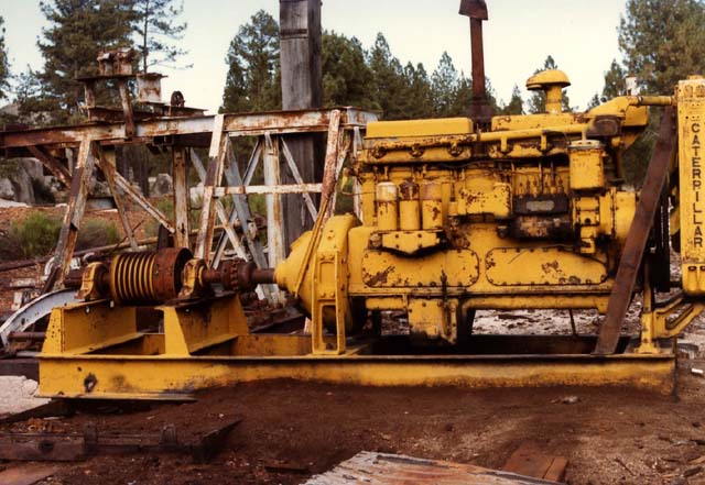
The equipment at Asserradero (the sawmill). Literally translated: the sawer.
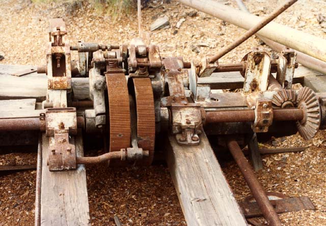
Some of the controls and gearing for the saw mill.
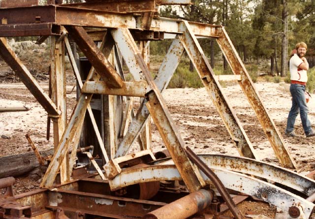
The control frame of the saw mill with Brue in the background.
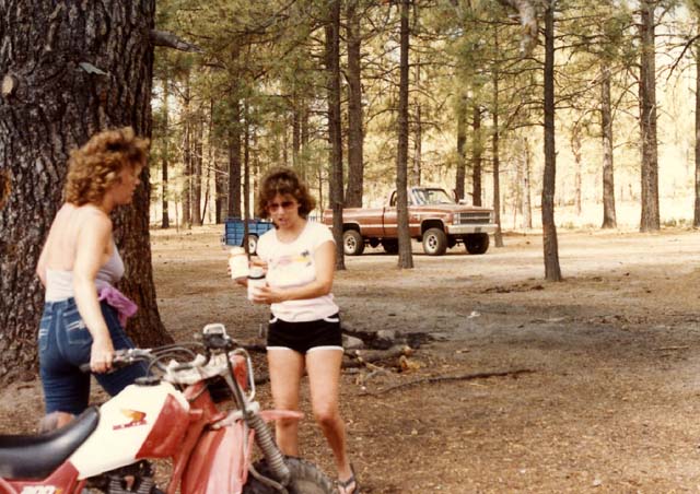
Holly and Nancy prepping for the trip home. Note the beers.
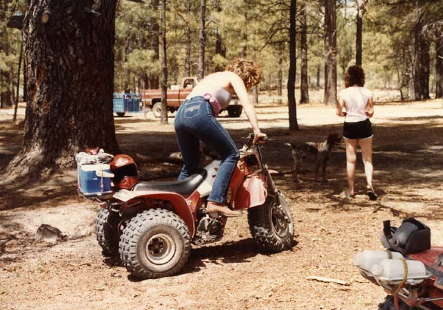
The kick-start from hell -- the Honda 200X.